

johndoe@gmail.com
Using a map, you might be able to determine the distance between two places to better comprehend what it meant for someone to travel a particular distance in a particular amount of time, or to understand more clearly the relationship between different places discussed in a text. Maps can also show us the locations of key features like rivers and mountains, as well as the political boundaries between cities, counties, states and countries.
Some maps, like the one used in the example below, give us more information than geography alone can provide. This map shows us the locations of German troops two months after the invasion of Normandy. Other maps can show us things like routes travelled or the locations of particular resources like industrial plants, mines, or farmland.
Source: CHAR 20/239/1
Description: Map of the Western Front marked "Top Secret" showing an estimate of the total number of German divisions.
Date: September 1944


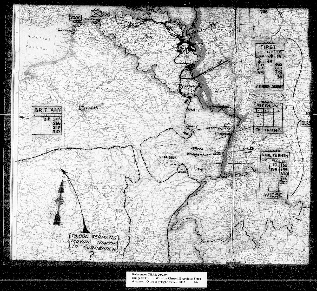

This British military map shows where intelligence indicated German troops were located along the western front.
Allied forces had landed in Normandy in June 1944, and this map two months later shows the locations of German troops (including some that are marked as being en route to surrender) at that point. In September 1944, Allied troops liberated areas that had been held by the Germans, including parts of France, Belgium and Switzerland. However, the war was by no means over and there would still be setbacks and battles with heavy Allied losses, such as the Battle of the Bulge in December 1944.
Ask yourself:
Ask yourself:
If you would like to learn more about this time period to contextualize this map, see this resource from the magazine The Atlantic which provides a description of the Allied invasion of Europe in summer and autumn of 1944, along with a variety of historical images
Choose from the types of primary source below to explore detailed examples that show useful ways to interpret each category, with handy tips and questions to ask yourself: